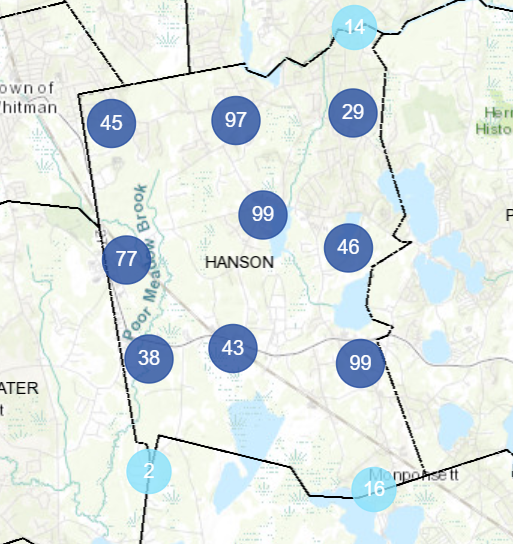
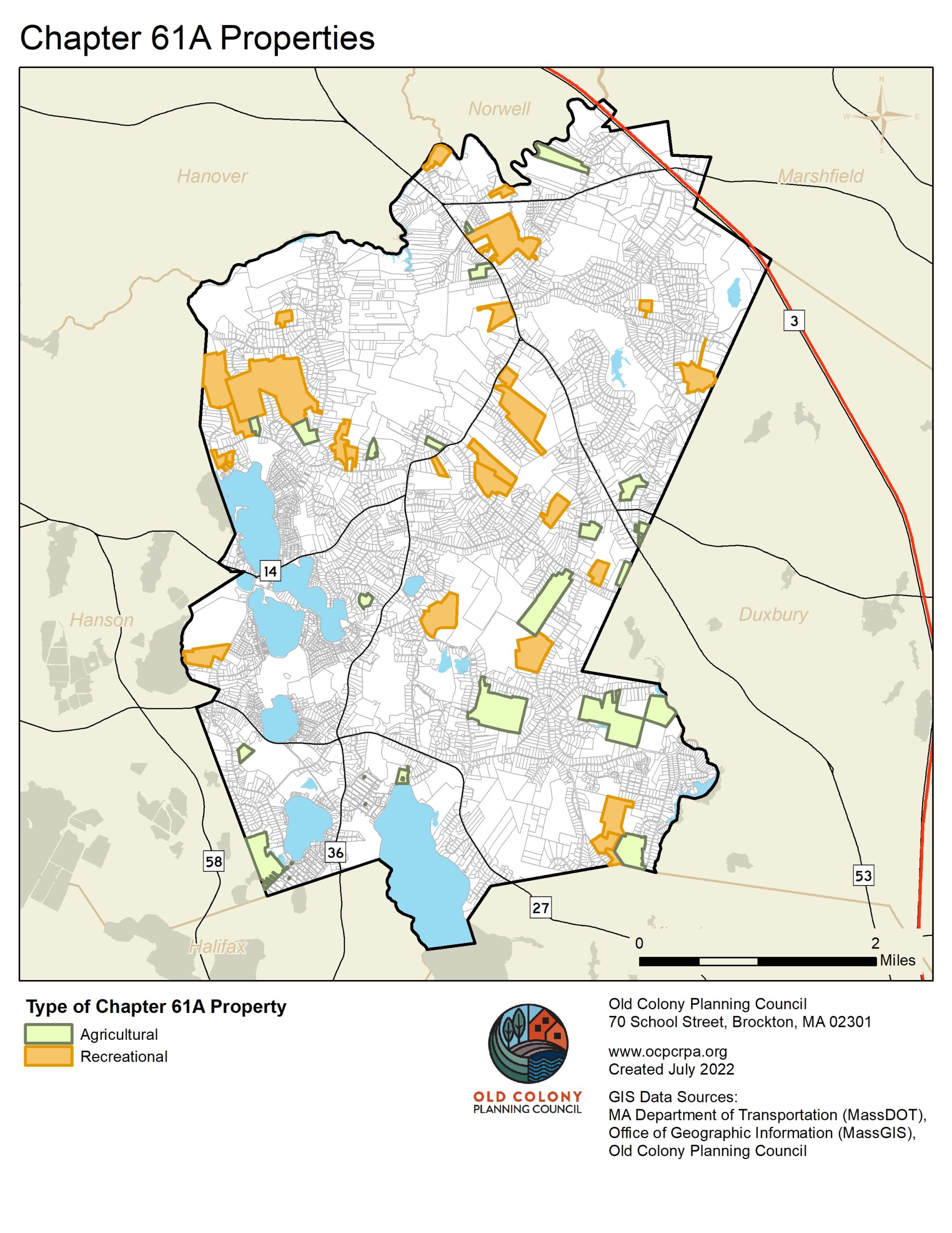
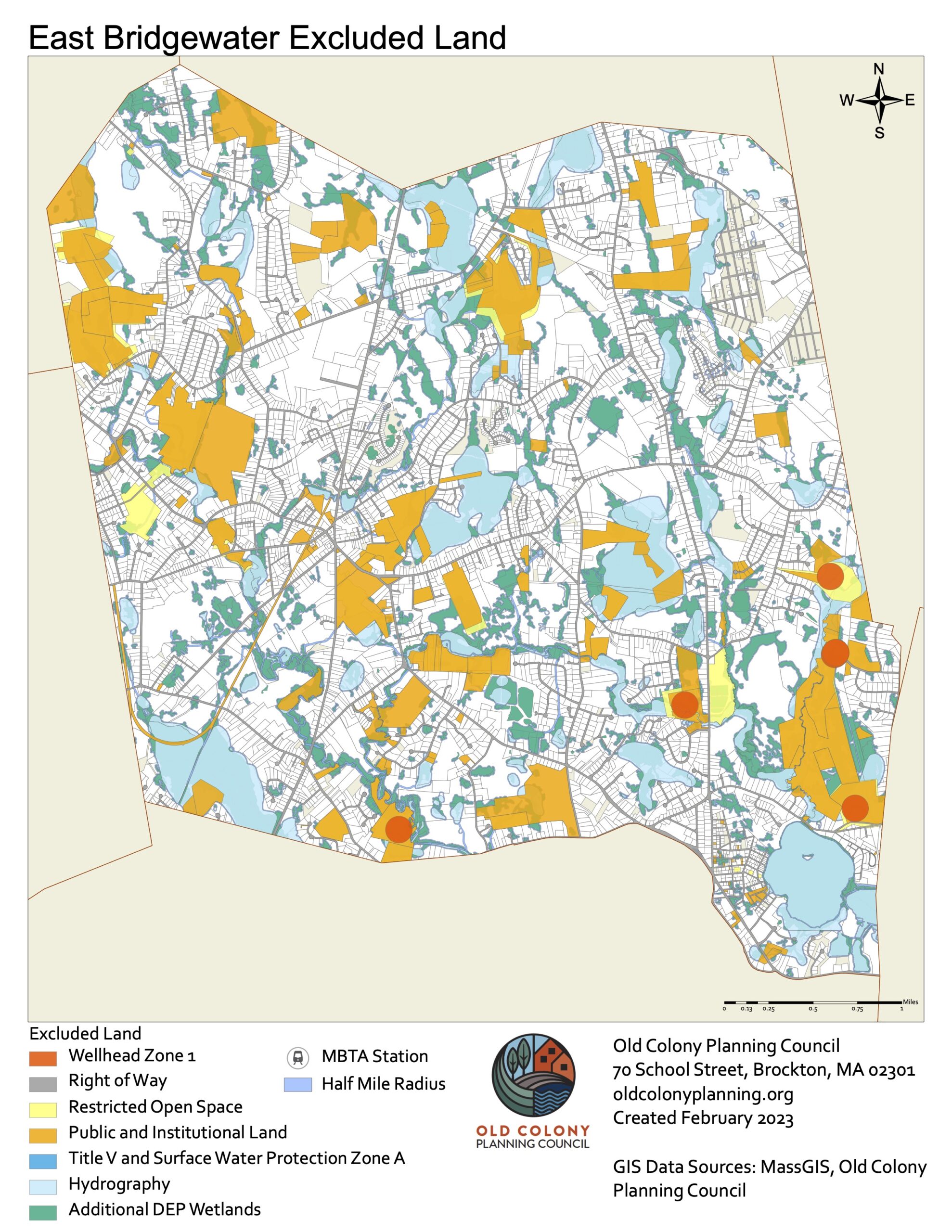
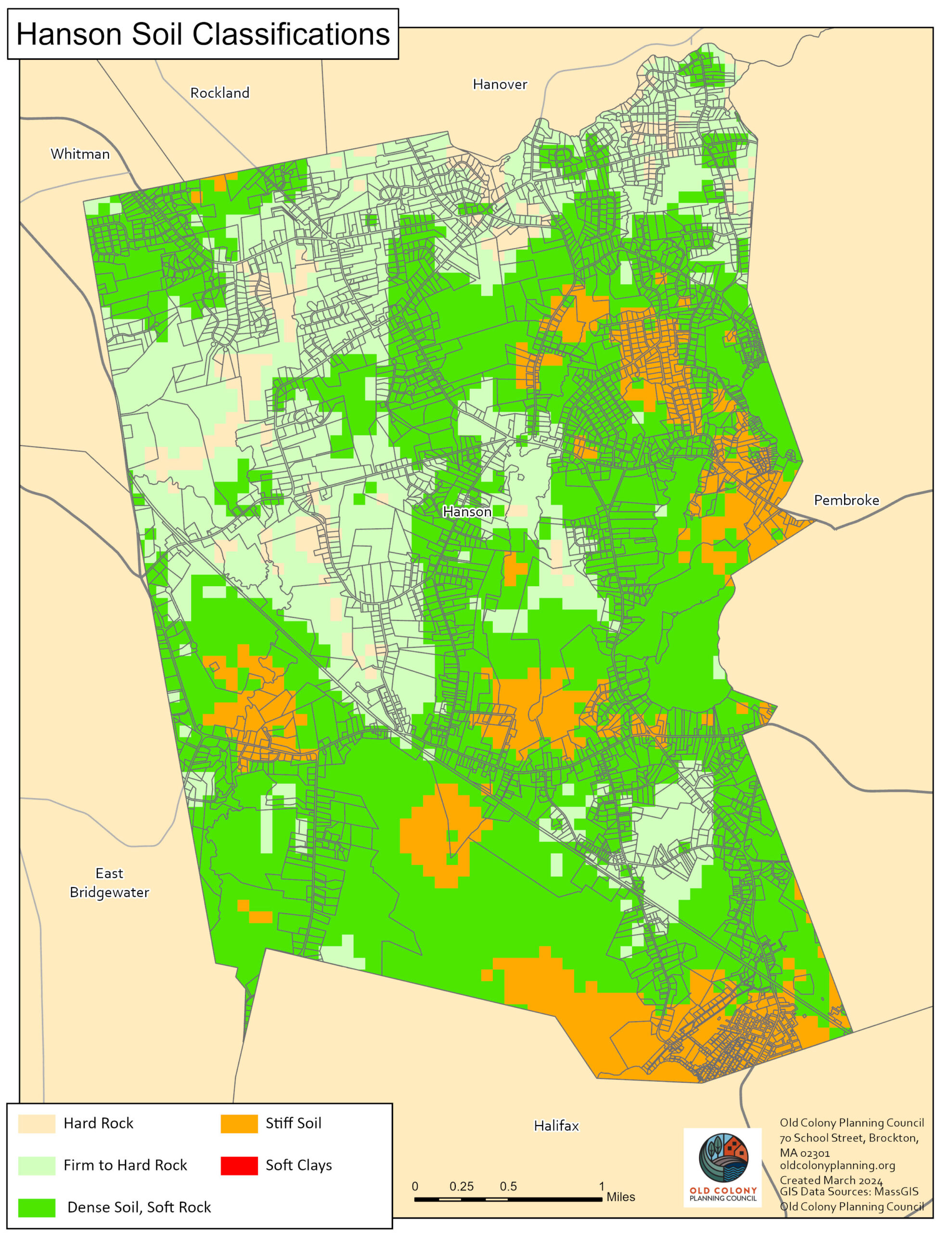
GIS & Mapping
The Old Colony Planning Council GIS Department provides data and mapping services to our departments, our communities and local organizations. From the beginning of the mapping process to the end, we can offer data collection, digitization of spatial information, data analysis, mapping and cartography services, large-format printing, and GIS training and assistance. We can provide accurate and comprehensive quality-controlled geographic data in a variety of formats and can make the data usable even to communities without GIS software of their own.
For information on how OCPC can help answer your geospatial questions, contact GIS Manager Andrew Vidal.